Parking lots now support dedicated access points, so you can mark exactly where drive aisles connect to the surrounding roadway instead of leaving entrances implied by an open edge. It's a small addition that makes circulation diagrams read clearly to anyone reviewing the plan, not just the person who drew it.
Alongside access points, we took a pass at the canvas grid overlay itself. It's lighter and simpler now, so it stays out of the way at every zoom level — especially on dense, multi-building sites where a busy grid used to compete with your linework.
How it works
Select a parking lot and place access points along its boundary from the properties panel. Each one is treated as an opening in the perimeter when the lot regenerates its stall layout, so curb cuts stay clean and aisles line up with the point of entry.
- Add, move, or remove access points on any parking lot boundary
- Stall generation automatically respects each opening
- Lighter grid rendering that scales cleanly across zoom levels
- Clearer circulation diagrams for review and client presentation
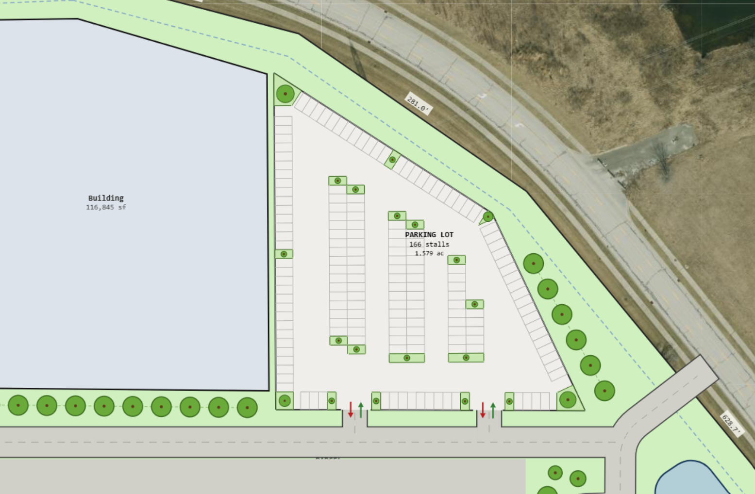
Together, these two changes are about legibility: making the plan easier to read at a glance, whether that's a zoning reviewer checking access or a teammate picking up your file for the first time.